
Looking for a Verizon Skyward Replacement?
We get it. Break ups are hard.
With Verizon’s Skyward shuttering their doors in short order, we’ve heard from a number of people in the commercial drone industry that they are looking for a drone fleet management solution post-haste.
The Aloft Air Control platform is a secure drop-in replacement for the Skyward drone apps and Skyward web platform. We work with teams from 2-2000 and have all the enterprise features you’ve come to expect from a mature web application.
Key Features for Migrating Away from Skyward
- We can quickly import your existing Skyward data into your Aloft Air Control account so you don’t miss a beat of compliance, and can save yourself hours of work.
- Our software is trusted across the drone ecosystem to help busy professionals manage groups of people flying fleets of drones across their organization.
- Our team is ready and waiting to help you easily transition off the Skyward platform and continue your important work using Air Control.
Aloft Air Control Features:
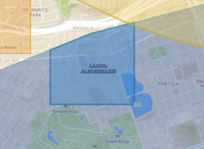
LAANC Autorizations
LAANC Authorizations are easy and fast on both iOS, Android and web! See why Aloft processes 70% of all LAANC.
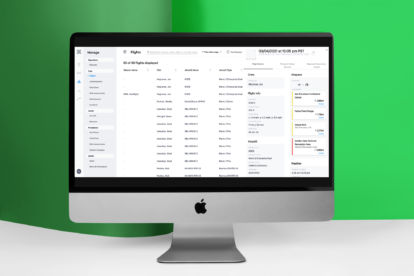
Flight Logging
Flight logging is easy from mobile or desktop.
Customizable Checklists, Risk Assessments, and Workflows
Checklists, Risk Assessments, and Workflows are all customizable for your SOP.
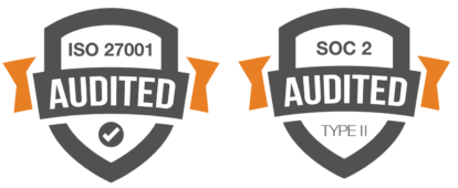
Enterprise Security
Full enterprise feature set including SSO/SAML, SOC 2 Type 2, and ISO 27001.

Secure Live Streaming
Secure live streaming from supported platforms.
Account/User Management
Full user permissions, roles, 107 Certification tracking and currency/recency reporting.
Reporting
Reporting made for busy drone program managers who need signal, not noise.


Tagging, Easy Searching and Sorting
Segment your organization the way you like with tagging, account separation, and easy searching and sorting.
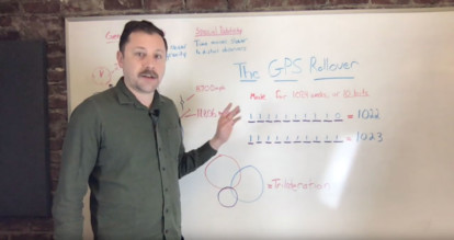
GPS Roll Over: What it means and why it's important to GPS
What do Einstein, Cesium, Satellites, and clocks have to do with the GPS roll over? More than you might think.
On April 6th, the American GPS system is going to “roll over” and it may cause malfunctions in older systems. In advance of this event, many companies that have GPS components in their equipment are making announcements about whether they’re affected by this or not.
Notably, the world’s leader in drone hardware, DJI, has already made an announcement that their drones will not be affected by this.
But what is a roll over anyway? And why is this such a big deal?
The roll over is referring to the way that dates are stored in the GPS satellites. As it turns out, time is an extremely important factor in determining position for reasons we’ll examine later. Let’s start out with what the roll over actually means.
As part of the date, the GPS satellites store the number of weeks since an epoch date. This is stored in binary and the size of that is 10 bits. This may sound terribly technical but it’s not. 10 bits simply means there are 10 positions to use to store that number. In binary, we count only with zero and one so for example.
0 = 0
1 = 1
2 = 10
3 = 11
4 = 100
….
1022 = 1111111110
1023 = 1111111111
What do you do when it gets to the 1024th week?! If your software and hardware has accounted for this eventuality, you’re fine. If not, you’re likely to have some very confused GPS receivers. If you were alive in the late 1990’s, this bug is not entirely unlike the Y2K bug.
But why is time so critical to GPS receivers? To understand this, we need to understand a little bit about how GPS works and some basic physics.
First, onboard each GPS satellite is an atomic clock. They use Cesium to keep track of the time within 2ns, or two billionths of a second. In conjunction with their very accurate clocks, they also know where they are because of the orbit that they’re in. The satellites package up these two pieces of information and send it out in a one way signal.
When your device with a GPS receiver boots up, it’s looking for at least 3 satellites to perform a process called trilateration. (The nerdier reader might notice that this process of positioning is not called triangulating and ask why. Since GPS is for a planet and not a circle, it needs to use spheres instead of circles to determine position -- and that’s called trilateration.) It reads the signals from those satellites and performs the complex calculations to determine where you are in relation to those three or more satellites.
When I say complex, I really do mean complex. The GPS satellite network is so sensitive that it begins to demonstrate the effects of “General Relativity” and “Special Relativity.” Because the array of satellites lives about 11,000 miles above the earth, they’re far enough away from the gravitational pull of the earth that time actually moves relatively faster for them. How much so? About 37,000 nano seconds everyday. This is an effect of “General Relativity”. And because the satellites are moving about 8,700 mph high above the earth, and we are sitting comfortably stationary here on the ground, they’re subjected to “Special Relativity” or the idea that a stationary observer will see things differently than someone on board the satellite due to the speed it’s traveling at.
Special Relativity is why you’re comparatively time-traveling the smallest bit every time you fly in a commercial airliner compared to your friends sitting back down on the ground. This accounts for about 8000 nano seconds of difference to the person trying to fly their drone, hail their Uber, or get directions to the hottest new dumpling place in town. Luckily, your GPS receiver takes care of all of these complex calculations for you.
So in conclusion, while the solution here may just seem as easy as adding another space for another couple of bits, this small design decision had a real impact on the integrity of the GPS system as a whole. Understanding how time and space relate, particularly as it relates to geo-positioning, is why an event like a date roll over is actually kind of a big deal.
https://youtu.be/f6YrxTE4sJM
Better, Faster, Safer: Drones in the Insurance Industry
Insurance company use of technology has long lagged behind other industries, but not anymore. With the onset of IoT technologies, and especially UAVs or drones, workflows and business processes are changing like never before. PWC estimates that drones save the insurance industry nearly $7 billion a year. More accurately, it’s the data from drones that is driving new efficiencies as legacy systems are replaced. Part 107 certified claims adjusters are the new rockstars of the industry.
Insurance is essentially about assessing, preventing, and mitigating risk with data. Insurers have been using data from telematics in risk mitigation for years in automotive fleet management and have since expanded into automobile and home insurance use. This is a win-win scenario that make customers happy with reduced premiums while limiting the amount of coverage that is necessary. Telematics data is the hidden hero.
The ROI of Drones for Insurance Companies
Drones are emerging in a similar way, but with even more immediate and stronger ROI.
There are many use-cases where drones are already making an impact in core insurance practices including: damage assessment, claims inspection, risk mitigation, underwriting and fraud prevention.
Industry leaders are routinely achieving 3-5X ROI from their drone programs, with claims inspection the vital workflow reaping much of the gains. With drones, images from the field can be evaluated before coverage is determined and turnaround times on claims are reduced drastically.
In the case of catastrophes and disasters, a drone can provide real-time video that captures the extent of damaged areas, long before the location is safe or accessible to vehicles. Insurance companies are also getting into the game of insuring drones and their operators opening whole new lines of business.
The ROI of drones for insurance companies is so large that they’ve been willing to navigate the complex set of software tools often needed to operate. As they add more Part 107 pilots to their operations, the biggest challenge is managing the data, assets and compliance needs that come with teams of 50, 100 and more. The challenge and opportunity of big drone data will increasingly become a focus for more leaders in the space. (Learn more about how Kittyhawk serves insurance companies.)
https://www.youtube.com/watch?v=_p2jFe_bfqU
Safer and Smarter Working Conditions for Adjusters
Companies are moving from dangerous, hands-on, time-intensive property inspections, to a quick, safe, and much faster process that allows workers to stay on the ground. Drones are replacing the ladders and handheld cameras adjusters would typically have to use to inspect damage. This is a welcome change as the Department of Labor reports that property adjusters have nearly 4 times the injury rate of construction workers.
Adjusters typically show up with little-to-no information about the property. Most of the initial details come from an internal form known as the First Notice of Loss (FNOL). Due to the nature of insurance, and their customers quickly filing claims after an event, the information is often vague. If their effort is focused around a leak or exterior damage, the adjuster then works backward to determine whether the problem is related to the roof, a window, or some other cause and then determine the cost of repairs.
Part 107 certified insurance adjusters in the field have an additional workflow to fly their drone in a safe and compliant fashion. They first need to check regulations and airspace to make sure they’re flying legally under safe and compliant conditions. Once they launch the drone, the first step is to get a general lay of the land and/or property to better understand what areas need more attention and documentation. Adjusters can then use the drone to get even more detailed photos or data, like measurements, in areas that garner further interest.
For houses, and even commercial properties, adjusters are doing complete inspections, using a single battery charge with drones in about five to fifteen minutes. A task that otherwise would take an hour or more. Adjusters are improving their time-at-site metrics by leaps and bounds. Three houses a day, is now three houses in an hour.
At every level, insurers are transforming their analog business processes with the entirely new data capabilities that drones enable. Ultimately the beneficiary is every one of us that when damage or disaster strikes, can get the financial help they need faster and easier than ever before.