Homepage - 2

The #1 FAA Approved Airspace Platform
Integrated Fleet & Airspace Management

One mobile, desktop, and developer platform for individual pilots, public safety, and the enterprise.
Find the Right Solution for Your Needs
We offer a wide variety of solutions for airspace and fleet management for individual drone pilots,
enterprise UAS programs, developers, and more. Whether you're looking for airspace management
capabilities, need to track your team’s UAS activity in one single data record, or simply apply for a
LAANC authorization, we've got you covered.


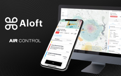
Air Control
One platform supporting
the entire Aloft community
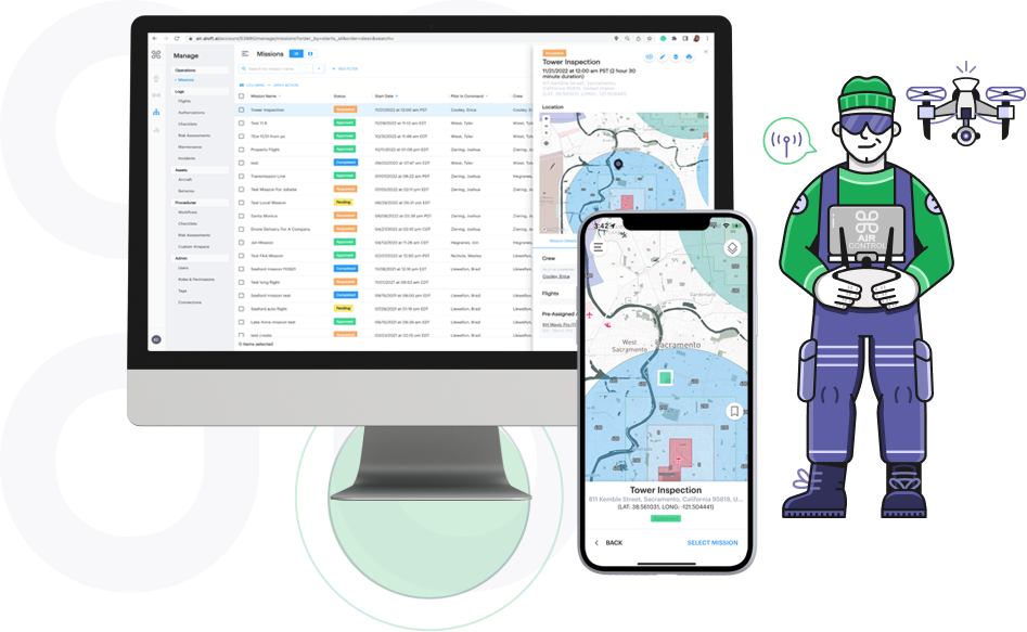
Aloft Air Control for Enterprise
The Air Control platform is one single data record for enterprise drone fleets
with additional features designed for enterprise UAS programs like user
management, reporting, enhanced SOC2/ISO27001 security, integrations
and APIs and more.

Start Using Aloft Air Control for Individual Drone Pilots Today!
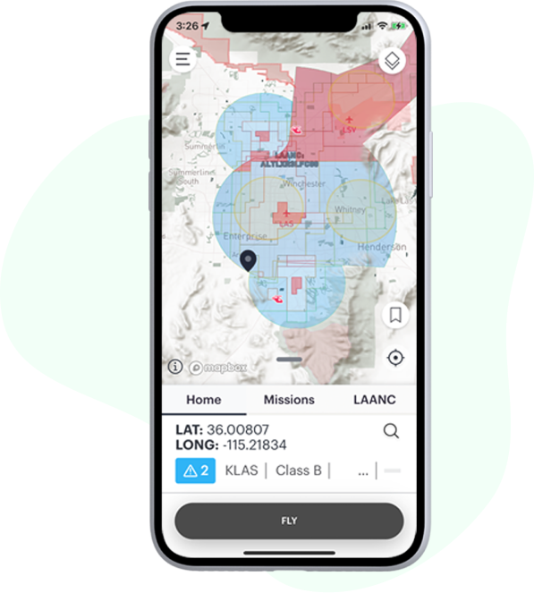
Aloft Air Control is now available for individual drone operators to use for free to
perform primary tasks like applying for LAANC authorizations in near real-time,
checking the airspace for nearby safety advisories and planning missions that
include fully customizable checklists and risk assessments.


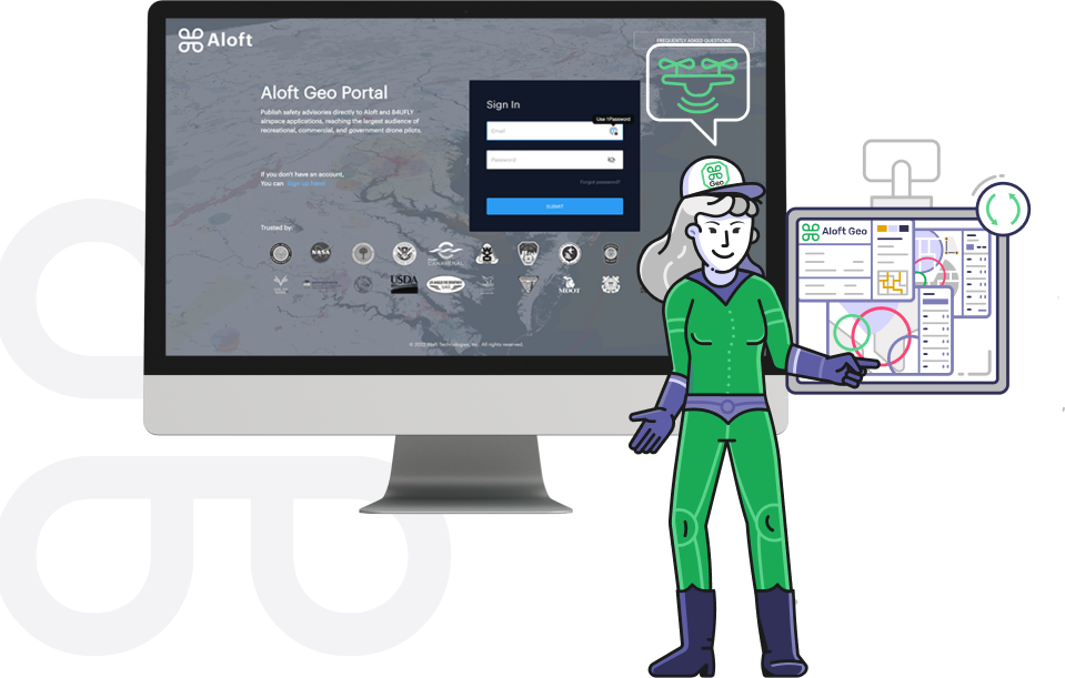
Aloft Geo Portal for Connecting Local Drone Rules to National Air Traffic Management
If you represent a government/ authoritative agency looking to submit local
drone rules and ordinance to the largest network of drone operators, get
started submitting your data for free to the Aloft Network (including the
B4UFLY platform) today using Geo Portal.
Trusted by:


Security
Your Drone Net Sec Layer
One secure data system of record from aircraft to mobile to web
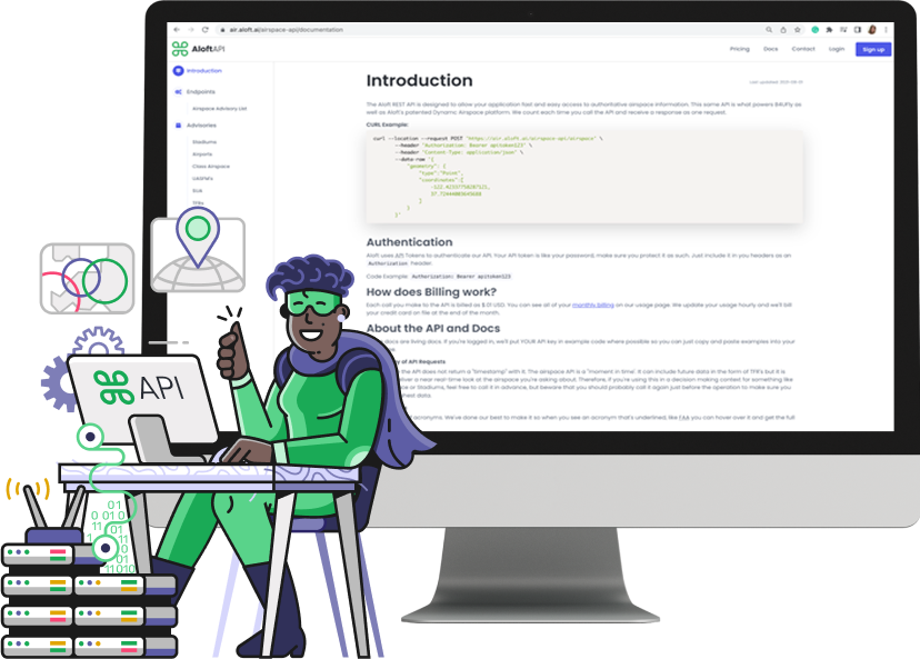
Developers
Exchange data and media with internal systems programmatically
through the Aloft API.

Read the Latest News
from Aloft


Listen to our podcast
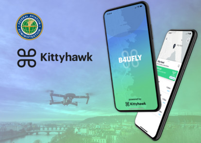
FAA and Kittyhawk IO Launch New B4UFLY App

New App Provides Real-Time Airspace Awareness for Drone Operators Across the United States
SAN FRANCISCO AND WASHINGTON - July 31, 2019 - Kittyhawk the market leader in drone software and the U.S. Department of Transportation’s Federal Aviation Administration (FAA) today introduced a new version of B4UFLY, the free mobile app that lets drone operators check the status of airspace prior to flight. Available now for iOS and Android, the app determines what airspace restrictions are in effect at any location in the United States, in real-time.
B4UFLY is a key tool in the safe integration of uncrewed aircraft systems (UAS) into the National Airspace System (NAS) that empowers recreational, commercial, and government drone operators with the situational awareness to fly safely and responsibly every time. More than 700,000 people have used B4UFLY since its original launch in 2016. B4UFLY is provided through a partnership between the FAA and Kittyhawk at no cost to taxpayers.
The new app leverages Dynamic Airspace, Kittyhawk’s patented airspace controller for managing real-time flight restrictions, authorizations, and guidance. B4UFLY programmatically consumes FAA data sources for controlled airspace, special use airspace, critical infrastructure, airports, national parks, military training routes, and temporary flight restrictions.
Based on location, B4UFLY provides simple, easy to understand airspace guidance that includes Good to Go, Warning and Do Not Fly. The app also provides links to helpful UAS educational content, safety resources, and LAANC, the FAA’s Low Altitude Authorization and Notification Capability for obtaining authorizations to fly in controlled airspace.
“B4UFLY is a hallmark of our commitment to ensuring drones are safely integrated into the NAS. Our partnership on B4UFLY with Kittyhawk represents the kind of public-private partnership that is essential to advance this burgeoning industry. As the skies become more crowded and UAS operations become more complex, basic airspace situational awareness, especially for the newest of fliers, will be essential,” said Jay Merkle, Executive Director, FAA UAS Integration Office.
“Kittyhawk was the birthplace of manned aviation and we’re proud to continue that legacy of innovation with the new B4UFLY app,” said Jon Hegranes, Kittyhawk CEO and Founder. “While the Wright brothers had a vast and soft landing area, drone pilots face sometimes complex rules and restrictions that can change quickly. Our goal with B4UFLY is to make knowing when and how you should fly simple, quick, and reliable.”
Future development of B4UFLY will include new capabilities for weather, Remote ID and additional data layers for uses in public safety, natural disasters and emergency response.
About Kittyhawk
Kittyhawk unifies the mission, aircraft and data to empower safe and effective drone operations. Based in San Francisco, the company develops full stack enterprise drone solutions for professional pilots and fleet managers in energy, insurance, media, transportation, and public safety. Founded in 2015, the company has received $9.5 million in aggregate funding from Travelers, Bonfire Ventures, Boeing HorizonX Ventures, Freestyle Ventures, and The Flying Object (TFO). Learn more at https://www.aloft.ai.
About B4UFLY
B4UFLY is the simple, easy-to-understand way for drone operators to check airspace before taking flight. Stay compliant, and contribute to a safer national airspace by making yourself aware of advisories and restrictions in the airspace around you. With B4UFLY, you simply open the app and select where you want to fly to see the status of the airspace selected, as well as details regarding surrounding advisories. B4UFLY is provided through a partnership between the FAA and Kittyhawk IO. Visit https://www.aloft.ai/b4ufly/ to download the app and learn more.