Homepage - 2

The #1 FAA Approved Airspace Platform
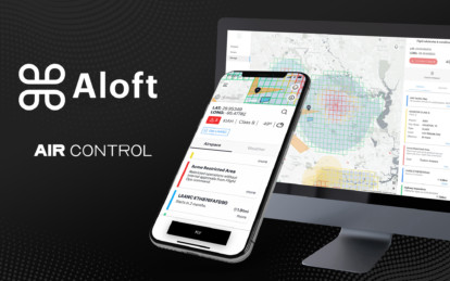
Integrated Fleet & Airspace Management

One mobile, desktop, and developer platform for individual pilots, public safety, and the enterprise.
Find the Right Solution for Your Needs
We offer a wide variety of solutions for airspace and fleet management for individual drone pilots,
enterprise UAS programs, developers, and more. Whether you're looking for airspace management
capabilities, need to track your team’s UAS activity in one single data record, or simply apply for a
LAANC authorization, we've got you covered.


Air Control
One platform supporting
the entire Aloft community
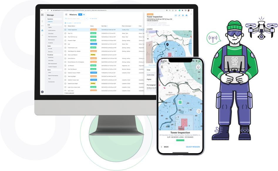
Aloft Air Control for Enterprise
The Air Control platform is one single data record for enterprise drone fleets
with additional features designed for enterprise UAS programs like user
management, reporting, enhanced SOC2/ISO27001 security, integrations
and APIs and more.
Start Using Aloft Air Control for Individual Drone Pilots Today!
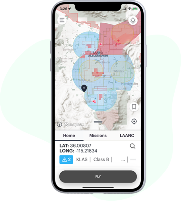
Aloft Air Control is now available for individual drone operators to use for free to
perform primary tasks like applying for LAANC authorizations in near real-time,
checking the airspace for nearby safety advisories and planning missions that
include fully customizable checklists and risk assessments.


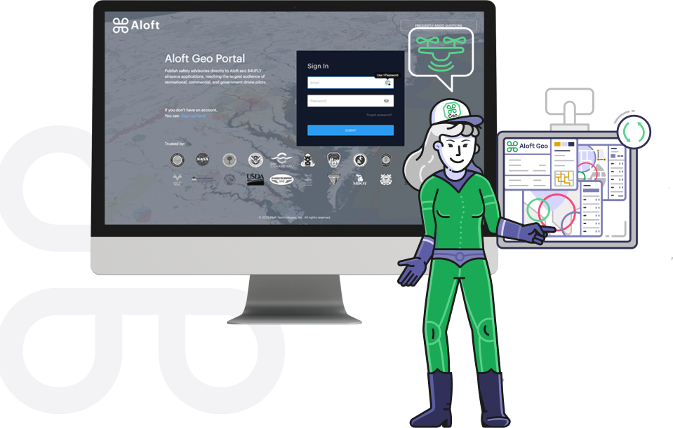
Aloft Geo Portal for Connecting Local Drone Rules to National Air Traffic Management
If you represent a government/ authoritative agency looking to submit local
drone rules and ordinance to the largest network of drone operators, get
started submitting your data for free to the Aloft Network (including the
B4UFLY platform) today using Geo Portal.
Trusted by:


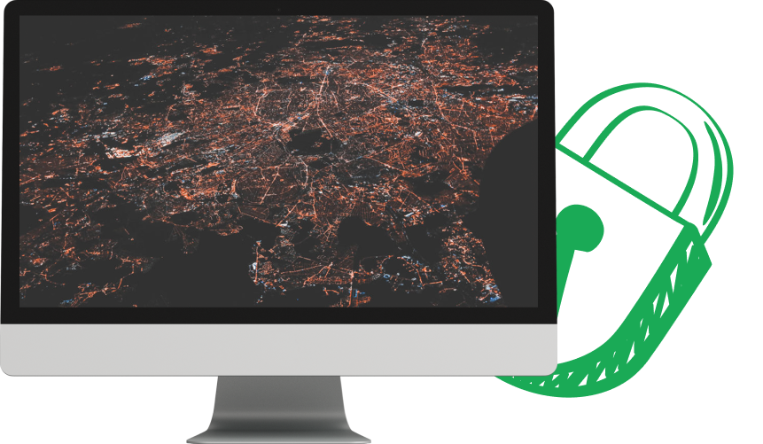
Security
Your Drone Net Sec Layer
One secure data system of record from aircraft to mobile to web

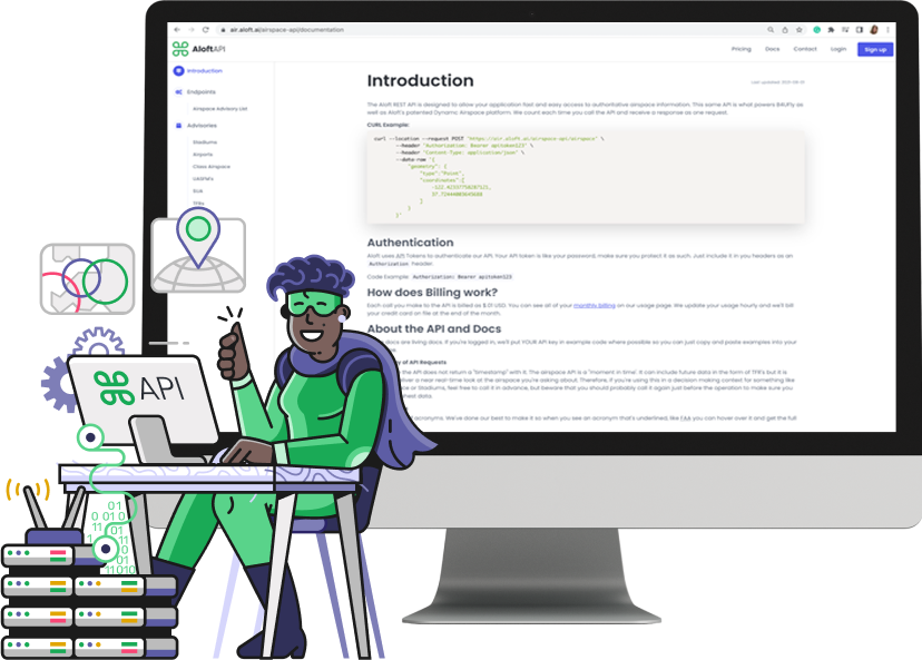
Developers
Exchange data and media with internal systems programmatically
through the Aloft API.

Read the Latest News
from Aloft


Listen to our podcast
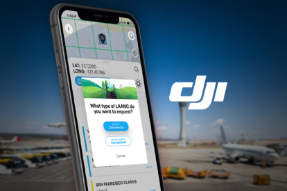
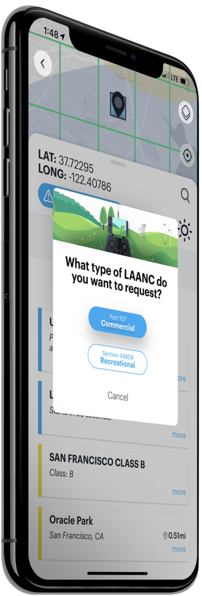
LAANC 2.0: Recreational Edition
Today we’re introducing LAANC functionality for recreational pilots, available on Android and iOS. It leverages Kittyhawk’s patented Dynamic Airspace platform and our recently launched LAANC 2.0 flow that makes it easier than ever to get a real-time authorization to fly in controlled airspace. It’s free for Kittyhawk users. LAANC a little or a lot, there’s no cost to fly and comply.
The airspace is becoming more integrated and that includes the rules by which drone pilots fly in controlled airspace. The launch of LAANC for hobbyist users is a major step forward for the FAA to bring a common set of operating rules and access to the National Airspace System (NAS).
We recognize the importance of all participants in the NAS to fly with an awareness of rules, regulations, and other aircraft, and we’re excited to bring this very important piece of airspace technology to the thousands of recreational pilots.
DJI, the world’s largest maker of personal and professional drones, recommends that its recreational customers use the Kittyhawk app for LAANC authorizations. “Opening the LAANC system to recreational drone pilots is an important step in the FAA’s efforts to safely integrate drones into American skies by providing innovative solutions to regulatory requirements,” said Brendan Schulman, DJI Vice President of Policy & Legal Affairs. “Kittyhawk is the app I personally use when I want to check the airspace. DJI is glad to be able to recommend Kittyhawk’s easy-to-use tools to fly in compliance with the new requirements for recreational flights in controlled airspace.”
While a relatively new program, more LAANC improvements and updates are in the works. We’re exploring new ways to make grids smaller and more dynamic, ultimately opening up more airspace in which to fly. We’re working on ways to make map data more precise and applicable for drone flights, which was not the original consideration when sectional maps were conceived. Ultimately we’re looking to bring more education and understanding to what it means to fly aircraft in the NAS, and we’re excited that all drone pilots now have the tools to operate in controlled airspace.
Last but not least, keep an eye out for an update on our development of a new and improved B4UFLY app. It’s yet another way that we’re connecting our airspace control engine Dynamic Airspace to more operators.
To download the latest version of the Kittyhawk app click here.
Kittyhawk NOTAM - DJI iOS Mobile SDK causing Auto-landing on M600, M100, Inspire 1, Phantom 3 Series, & A3/N3 flight controllers.
DJI iOS Mobile SDK causing Auto-landing on M600, M100, Inspire 1, Phantom 3 Series, & A3/N3 flight controllers.
On December 25th, Kittyhawk was notified by DJI that a previous release of their iOS Mobile SDK (v4.7) has been known to cause the above aircraft models to occasionally determine they are within a no-fly zone, initiating landing during flight. This affects all users flying within Kittyhawk Flight Deck and may cause unexpected auto-landing while in flight on the M600, M100, Inspire 1, Phantom 3 series, and A3/N3 based aircraft.
DJI has released a new version of the iOS Mobile SDK that resolves this bug, we are in the process of implementing this update and will be providing the Apple App Store with a new version for review/publication on the market promptly. This fix will be included in the early-January iOS release on the App Store.
If you have questions or are unsure if this bug will affect you, please contact your Customer Success representative.
Thank you,
Kittyhawk Customer Success Team